NASA Kennedy Space Center (KSC)
NASA Kennedy Space Center (KSC)
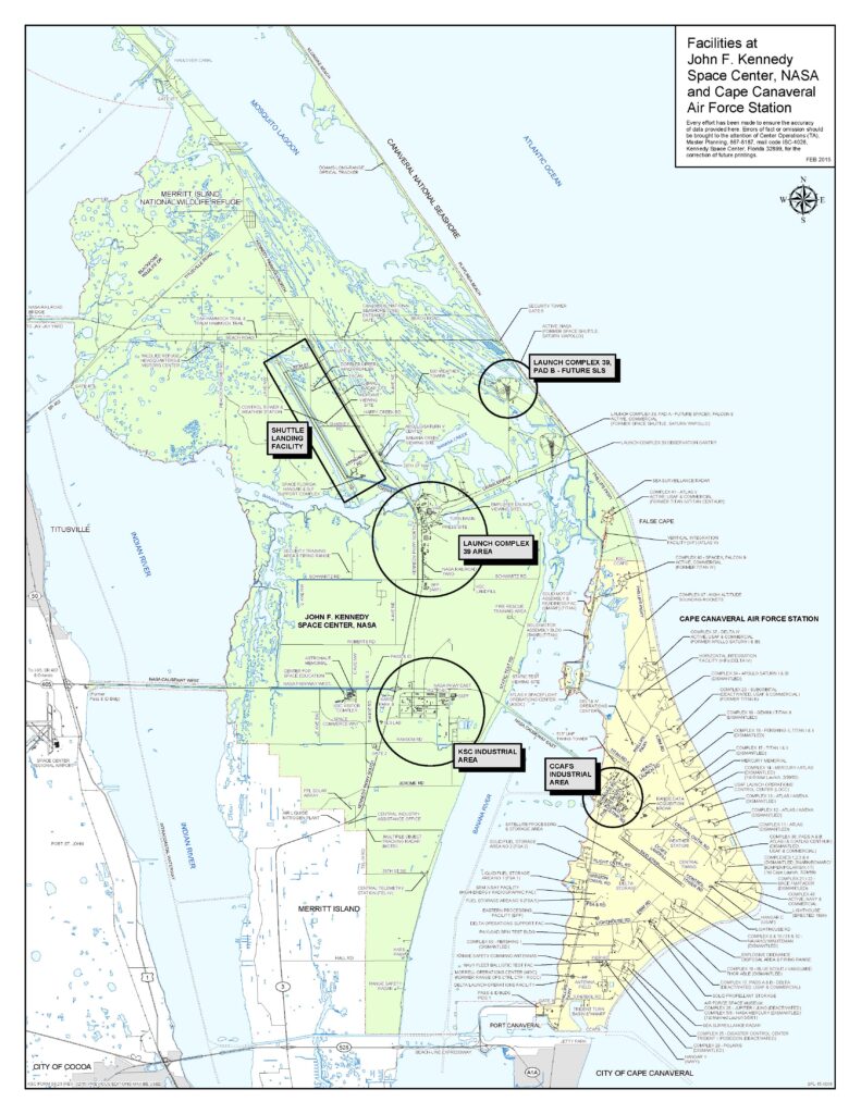
KSC (Kennedy Space Center) is one of 10 NASA field centers, is a premier multiuser spaceport with more than 90 private-sector partners and nearly 250 partnership agreements. Once known as Cape Kennedy, opened 1968. KSC is adjacent to Cape Canaveral Space Force Station (CCSFS). Location: Merritt Island, Florida.
Kennedy Space Center (KSC), Cape Canaveral, Port Canaveral, Merritt Island, Florida, FL, USA.
Weather
- Kennedy Space Center Radar
- National Weather Service US
- National Weather Service US, Melbourne (NOAA)
- National Oceanic and Atmospheric Administration (NOAA)
- Space Launch Delta 45, 45th Weather Squadron, East coast USA
- Patrick Space Force Base (AFB, Merritt Island, Florida. IATA: COF, ICAO: KCOF, FAA LID: COF)
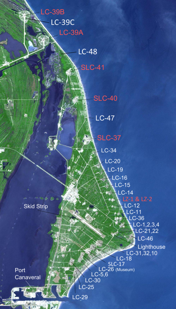
Launch Complex (LC), Space Launch Complex (SLC) and pad (A, B or C)
Status: Active
LC-13 and Landing Zone LZ-1 and LZ-2
- Prior: Atlas, Atlas Agena.
- Current: SpaceX Falcon 9
- Future: SpaceX Starship progress
- Future: Phantom Space, Vaya Space.
LC-16
- Prior: Titan I, Titan II, Pershing 1a, Pershing II, Terran 1.
- Current: Relativity Space.
- Future: Terran R.
LC-36A
- Prior: Atlas-Centaur, Atlas I, II and III.
- Current: Blue Origin progress
- Future: New Glenn, New Armstrong.
LC-36B
- Prior: Atlas LV, Surveyor D, Atlas-Centaur, Atlas I, II and III.
- Current: Blue Origin progress
- Future: New Glenn, New Armstrong.
LC-37
- Prior: NASA Saturn I, Saturn IB, Delta IV Medium, Delta IV Heavy.
- Current: ULA Delta IV Heavy.
- Future:
LC-39A
- Prior: Saturn V, Space Shuttle.
- Current: Falcon 9 Block 5.
- Future: SpaceX Starship progress
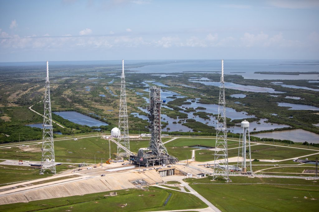
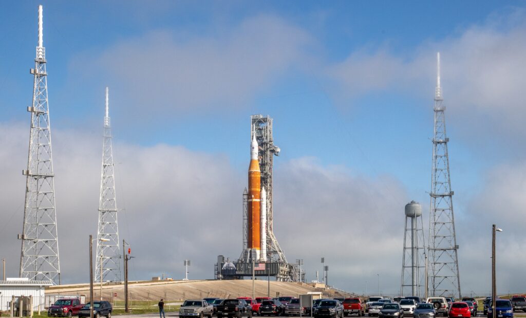
LC-39B
- Prior: NASA Saturn V, Saturn IB (Skylab and Apollo–Soyuz), Space Shuttle, Ares 1-X.
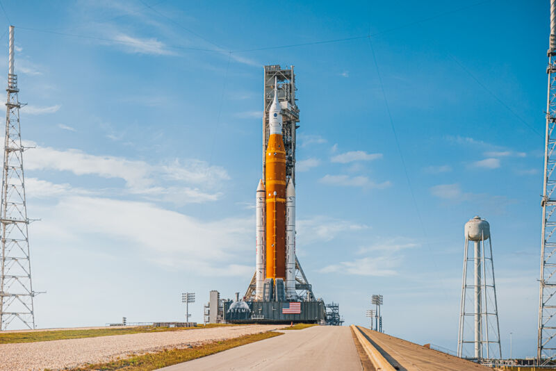
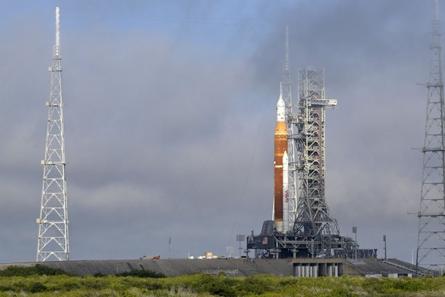
- Current: NASA Space Launch System (SLS), Artemis progress
- Future:
SLC-40
- Prior: Titan III, Titan IV, Falcon 9 v1.0, Falcon 9 v1.1.
- Current: SpaceX, Falcon 9 Block 5.
- Future:
SLC-41
- Prior: Titan III, Titan IV.
- Current: ULA Atlas V, Vulcan Centaur. Peregrine Lunar Lander.
- Current: Boeing Starliner progress and sequence of events
LC-46
- Spaceport Florida and Astra.
- Prior: Athena, Trident II, Minotaur IV, Rocket 3.
- Current: ?
- Future: Rocket 4, Rocket 5.
Launch Pad Facilities
- Flame trench is directed to the ocean.
- The launch pads are on an elevation to make room for the flame trenches. This volume would otherwise be below sea level.
- Water deluge to protect the pad and dampen the sound vibrations.
- A catenary system is designed to intercept a direct lightning strike and convey it to ground immediately adjacent to the protected facility.
Orbit
- Direction East: Launch from Kennedy Space Center.
- Direction South: Launch from Vandenberg Space Force Base.
Facilities
- BFF: Booster Fabrication Facility.
- Blue Origin launch vehicle factory.
- Hangar AE. Used by the Launch Services Program (LSP) and other customers as a communications center, receiving and monitoring telemetry data from launch vehicles and spacecraft on the ground and during flight.
- Hangar X. Roberts Road Facility (SpaceX).
- LASF: Launch Abort System Facility.
- LCC: Launch Control Center. See NASA mission management.
- LVDC: Launch Vehicle Data Center.
- MDC: Mission Director’s Center. Senior management.
- OCB: Operations and Checkout Building (O&C Neil Armstrong). Suit-up area near LC-39. Orion (Lockheed Martin).
- OPF: Orbiter Processing Facility. Starliner CST-100 (Boeing).
- PHSF: Payload Hazardous Servicing Facility.
- RPSF: Rotation, Processing and Surge Facility. Solid rocket boosters.
- SSF: Space Station Factory.
- VAB: Vehicle Assembly Building.
- Runway landing facility 15/33. Space plane X-37 by Boeing, Shuttle Carrier aircraft, Space Shuttle (prime landing site). Single 15,000-foot (4,600 m) concrete runway.
Sea
VAB Area Turn Basin and Dock
- The LC-39 turn basin and dock, east of the VAB, provides a direct water connection between the Atlantic Ocean and space launch processing activities at KSC. Utilizing a dockage area 1,800 feet long and 1,700 feet wide, the turn basin was used by both the Apollo and Space Shuttle Programs to receive fuel tanks and other elements too large to travel over open roadways.
- The turn basin maintains a depth of 10-15 feet at the cargo transfer point and deepens to approximately 25 feet near the middle.
Barge Canal
- Port Canaveral provides water access to KSC facilities through a canal that links the port with the Intracoastal Waterway in the Indian River. The connection is the result of moving the west dike of the port 4,000 feet into the Banana River and building a 90-foot by 600-foot lock in the relocated west dike.
- A dredged channel from the lock to the Merritt Island Barge Canal creates a water connection between the ocean and the Intracoastal Waterway.
- A KSC barge mooring is located at the intersection of the barge channel and the barge canal near the Canaveral Lock. This area has a depth of 25-30 feet. It provides a holding area for barges that will be moved up a dredged channel to the CCAFS dock facilities and the turn basin in the VAB area.
External Port Access – Port Canaveral
- Located at the south boundary of CCAFS, Port Canaveral consists of an entrance channel and turning basins dredged to accommodate oceangoing freighters and passenger cruise liners. Harbor facilities for Air Force and Navy activities at CCAFS are located north and northeast of the turning basins.
- The Navy has constructed a 45-foot-deep turning basin and 1,200-foot pier on the north side of the entrance to Port Canaveral. The pier has a 105-ton crane available to other government users on a noninterference basis. This facility is primarily used for the Trident Submarine program and is homeport to the Navy ship USNS Waters, which supports submarine operations.
- Commercial harbor installations include a wharf on the south shore of the harbor equipped for unloading petroleum products into nearby tanks. Commercial and sport fishing boats dock in the harbor south of the turning basin. Cruise terminals are located in the west turning basin and there is a marina southwest of the cruise terminals.
Footnote
- Sources: Aerospace dashboard, NASA mission management, funkystuff.org
- Outgoing: NASA
- Keywords: Spaceport

